Work steps:
- Definition of data required for planning, sizing and operational optimization of KNWN:
Data requirements for effective use of planning tools and computational models will be identified to enable accurate planning and operational management of KNWN. - Acquisition of relevant data:
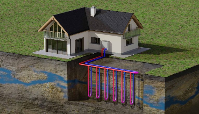
Necessary data such as surface climate data, precipitation values, sealing, shading, heat network data, building data and information about existing objects in the subsurface are collected. - Development of geospatial data infrastructure and geoportal:
A comprehensive geospatial data infrastructure will be developed to meet the requirements for integration of heat grids, cooling, heat pumps, geothermal storage, and other source systems. A web-based geoportal will allow visualization and interaction with the collected data. - Interface integration for georeferenced heat networks and monitoring data:
Interfaces will be created to integrate georeferenced heat networks and to integrate monitoring data (from work package 2) into the geoportal. - Development of algorithms for spatial and hydrogeological potential exploration:
Algorithms are developed to analyze and visualize the potential of geothermal systems in conjunction with KNWN. This includes visualization of potential indicators, georeferenced heat networks and other subsurface objects. - Visualization of the heat network route and the connection to buildings:
The route of the heat network routes and the connections of the KNWN to the buildings are clearly displayed. - Automated determination of building parameters:
Algorithms are being developed to automatically determine important building parameters such as number of floors, proportion of window area, shading and year of construction. - Integration of planning and approval-relevant boundary conditions:
Practical boundary conditions from the planning and approval of KNWN are integrated into the geothermal grid information system to ensure realistic planning.
Work package 3 aims to build a robust geospatial data infrastructure that enables comprehensive visualization and analysis of the relevant data. The web-based geoportal will serve as a tool to view and understand the different aspects of KNWN planning and optimization in an interactive environment.